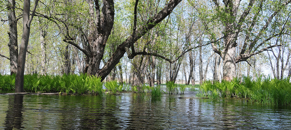
As MacEacheran describes, after the last Ice Age, “Retreating glaciers left behind a great depression characterised by sedimental mires, and nowadays Soomaa remains Europe’s largest intact peat bog system – essentially a humongous natural sponge.” The yearly saturation of this “sponge” has facilitated a local industry with guides who take visitors on canoe tours through the seasonal networks of icy water, submerged pastoral scenes, and bare trees poking out in between.
Snow melt and bursting riverbanks are nothing new to Canadians, but for some places in Canada, flooding is a life source rather than a menacing cause of property damage; just like Estonia's “fifth season” has become an event that locals embrace, at least in recent years.
Where might we find a place like this in our local area, with similarities to Soomaa National Park? There are some technical differences, but you can witness an ecosystem like it just twenty minutes west of Barrie, Ontario, in Minesing Wetlands. Flowing into the wetlands are a collection of rivers and creeks, including the Nottawasaga River, Mad River, Willow Creek, and Bear Creek.
The rivers themselves flow over sedimentary rock that was formed by marine life, living in what was then warm water, during the Devonian Period around 400 million years ago. Glacial activity then scraped that rock. The glacial ice melted, and over many thousands of years, the water levels fluctuated repeatedly. When water levels in the wetlands were at one of their higher points, there was an island. This is where the name Minesing comes from, as it means “island” in Ojibwe.
With a size of 60 square kilometres, Minesing Wetlands is quite a bit smaller than Soomaa National Park, but it's packed full of animal and plant life that are sustained by the wetland environment. Thousands of migratory waterfowl pass through here each year, making the most of spring flooding. The available habitat space means that even black bear sightings have been known to happen. You'll hear the songs of miniature warbling songbirds with vibrant yellow feathers. The area is also significant in Ontario for its heron population. Bring some binoculars, so you can look out for birds in the trees and among the vegetation.
North of the town of Angus, you can see these birds on the 12 foot tall wooden Minesing Waterfowl Tower, at the corner of Concession Road 2 and McKinnon Road. You'll be looking across a place which, as explained by the Minesing Community Association, is “one of the most diverse undisturbed wetland tracts in Canada.” These qualities all contributed to this area becoming a designated wetland in 1996.
One difference between Minesing Wetlands and Soomaa N.P. is that the former contains several different types of wetlands: fens, swamps, marshes, and bogs. A fen is a nutrient-rich, alkaline wetland that's fed with groundwater from under the water table. Marshes are wetlands with grassy plant life. Swamps have trees and shrubs. Bogs — what you'll find in Sooma National Park — have a high peat content, less nutrients, and are more acidic. You can find all four of these wetland types in Minesing Wetlands.
However, on the surface, there's quite a lot in common when it comes to the eerie, magical scene you'll be surrounded by; and in terms of what you can do in these places.
For instance, they're both great destinations for kayaking and canoeing. On the Nottawasaga River that goes through Minesing Wetlands, one can paddle from Alliston to Wasaga beach on Georgian Bay. Some places you can access for boating are by the Waterfowl Tower or in the town of Angus. In normal times, excursions are operated by the Friends of Minesing Wetlands. There's snowshoeing in winter and paddling in the spring.
A 10 minute drive on the highway from Angus is the Tiffin Centre for Conservation, where you can park your car, play nine holes of frisbee golf, traverse 17 kilometres of trails, go for a maple syrup tour, and then get some locally made syrup on the way out.
Upon securing a Nottawasaga Valley Conservation Authority (NVCA) fishing permit, you can fish for rainbow trout, northern pike, and carp — among other varieties — from one of the allowed river access points.
For any of these activities, the NVCA website has informational highlights and a PDF map of the area (https://tinyurl.com/598ey8bk), showing where you can swim, launch a boat, and more. The site also has a list of safety points to keep in mind, and recommendations of equipment to bring along, whether you're out and about on the water or on the trail. Just like in Soomaa N.P., conditions can vary greatly from season to season. Once you're at any of the NVCA conservation areas, parking for the whole day costs 10 dollars per vehicle, which is used to finance the upkeep of the conservation areas.
Perhaps it's a surprise, but a destination that's submerged underwater can offer a multitude of options for a family outing on a nice day.
Written by Vincent Teetsov, Toronto
