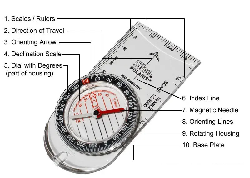
Let’s say you are hiking somewhere far from towns and cities and are seeking out a particular landmark. A mountain or a lake for example. Perhaps you are planning to walk a circular route. Or you are going out from a campsite for the day and need to come back. How can you be sure that you’re moving in the correct direction towards your intended destination? A paper map and a physical compass is the answer.
Sure, walking on designated trails is always wise. However, if you lose your way on the trail or are hiking somewhere less frequented by other people, a map and compass won’t fail you. It will also hold up even if your phone or a dedicated GPS device breaks or runs out of charge.
The map:
First, get to know the map of your area. This should be a recent map, so that the declination (the difference between true north and the magnetic north your compass points to) is up-to-date. If an old map is all you can access, search the internet for the current magnetic declination of the area and write this on the map (which will be x number of degrees west or east). Also look for landmarks such as rivers, lakes, mountains, trails, or roads that may be highlighted on the map.
Täismahus artikkel on loetav Eesti Elu tellijatele
Igal nädalal toome me sinuni kõige olulisemad kogukonna uudised ja eksklusiivsed lood uutelt kolumnistidelt. Räägime eestlastele südamelähedastest teemadest, kogukonna tegijatest ja sündmustest. Loodame sinu toele, et meie kogukonna leht jätkuks pikkadeks aastateks.
Hind alates $2.30 nädalas.


